By Chao C. Chien
Originally published at Diogenes Research
There is no longer doubt that the Age of Discovery was not brought on by European explorers. But then, if they did not “discover” the world, who did? Of course, as many overly eager revisionist theorists allege, the Chinese did, basically on account of the grand maritime naval exercises conducted by the Ming Chinese at the beginning of the 15th century being so close to the start of the European discoveries. Of course, some are driven by reasons that are more personal, such as nationalism. However, is that enough of a justification for revising history? No, that is not. We need something more concrete. I have furnished an argument, based on the analyses of factual evidence, in the book The Chinese Origin of the Age of Discover. Indeed it is now being serialized right here on this website. Nevertheless, it is clear that to some readers that which is being presented in the book may still prove too complex for comprehension. After all, one cannot expect we all be experts in the fields of history, geography, linguistics, philology, and cartography. So, in this article I shall take what is in the book and expand it, in hope that we may all understand the research better.
Let us begin our story two centuries before the real action traditionally began. Hey, if we are to tell a story, why not start from the very beginning, right?
Back in the late 12th century a poor Mongol boy was born in Siberia, but the poor boy was to grow up and become “the” greatest military leader the world had known, greater than Alexander and all the other pretenders.
This boy was name Temujin, better known to us as Genghis Khan. Many scholars had tried their hands at translating this title. Some claimed that it meant a king as great as the ocean, others said it meant ruler over all. In essence, it is basically what Westerners call King of Kings, or so-and-so “The Great.”
Genghis Khan spent his entire adult life leading his mighty Siberian horsemen conquering nations. When he had consolidated the Siberian tribes into an almighty fighting force, his newly created nation came into contact with several neighbors, notably the Jin (forerunners of the Manchu who several hundred years later conquered China) on it south and southeast, and Xi Xia, or Western Xia of a people called Tanguts on it southwest. In 1206 Genghis Khan took out Xi Xia. Then he turned on the Jin, erstwhile overlord of the Mongols. By 1215 Genghis Khan had sacked the Jin capital, present day Beijing, China. Jin then moved its capital to Kaifeng in present day Hunan Province of China, south of the yellow River. Song China by then had shrunk to the south of the Yangtze River. Genghis Khan passed away in 1227, but his son Ogotai Khan finished the job in 1234 and snuffed out the Jin.
Previously the land of the Jin, northern China, belonged to the kingdom of Liao of the Khitan people, who had captured the land from the Song Chinese, forcing the latter to move south and became what historians called the Southern Song. In 1125 Liao was taken over by the Jin. The remnants of the Liao royalty fled west and established the kingdom of Kara-Khitai in present day Chinese Turkestan, Xinjiang Province and Central Asia. Kara means west, thus in Chinese the kingdom is known as Western Liao. The name Khitan was pronounced in the west as Khitai, which in time evolved into Cathay. The people of the west identified them with the Chinese, thus the names Khitai (Russian Kitai) and Cathay became the names of China.

Mongolia, Jin, Tangut, Kara Khitai, Southern Song China
The Mongols were victorious in their campaigns, and by the middle of the 13th century had extended their domain into Eastern Europe. In 1279 Genghis Khan’s grandson Kublai Khan succeeded in conquering Song China and initiated the Yuan Dynasty there.
The people of southern China were called Man (m-AH-n). The name can dialectically be Min, Miao, and Hmong (the people featured in the Clint Eastwood movie Gran Torino), among others. Because of the northern Chinese’s haughty attitude toward their southern brethren, the name Man had taken on the meaning of savages or uncivilized people. After the Mongols had conquered China they turned around and used this derogatory term on the Chinese themselves and called the southern Chinese Manji, savage ones.
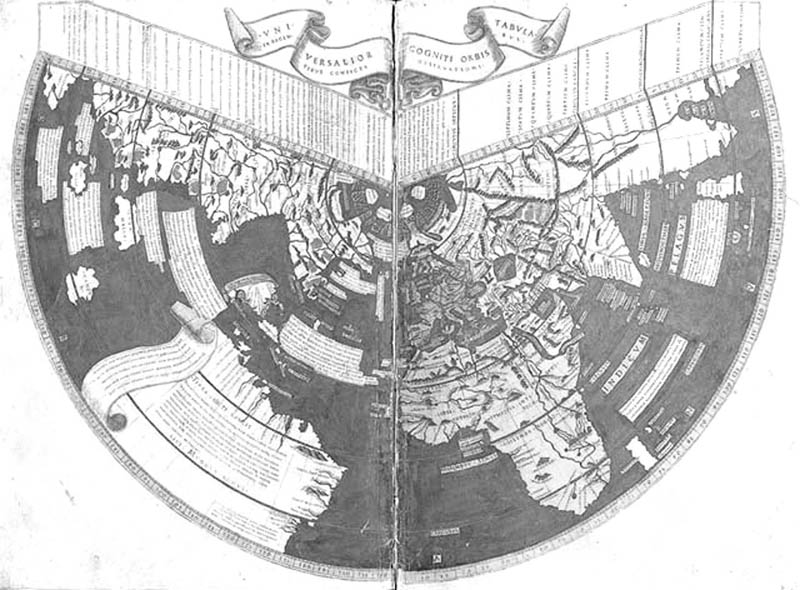
1507 Ruysch Map

Asia and America Are Separate Continents
In a 1507 (15 years after Christopher Columbus set sail for the Caribbean) World Map by Ruysch there are some very interesting names. If you look closely you will recognize them.

1507 Ruysch Map Inset
In the enlarged view you should be able to see Cathaya (Cathay), Tangvt (Tangut), Tebet (Tibet), Mangi (Manji), and others. And where are these names? Ho, ho, ho, they are not in Asia but in northeast North America. Oops! Did I say northeast North America? European mapmakers knew about northeast North America 15 years after Columbus first set sail? Yes. The map is there, clear as daylight. But Cathay, Tangut, and Tibet are supposed to be in Asia, not America. So, the mapmaker pulled a double booboo. They transferred Asian geography to America, and they knew America when they were not supposed to.
In the 1536 Oronce Fine World Map we have the same things.


1536 Oronce Fine World Map
My dear readers, I think by now you should be familiar with the logic here. By placing Asian names in North America it tells us the mapmakers had no clue on what they were drawing, yet they clearly had in their possession Asian names such as Tangut and Manji. That they drew the Americas and Asia as one continuous landmass tells us that they were not working with European exploration data. For one, if they had surveyed those places, they would not have drawn them so miserably wrong. Second, by 1507 and even 1536 there was not enough time for them to have surveyed the new continents. So, how did they know the shape of America; where did they get their data from? Certainly not from Marco Polo, who not only did not go to eastern Asia, he died in 1324, almost 200 years earlier.
Could some European have brought back the map material from the east? Did Europeans travel to the east at that time? Most certainly they did. For instance, papal envoy Giovanni da Pian Carpini went to see the Mongol Khan Guyuk in 1245. In 1254 the Flemish William of Rubruck went to see the Khan. In 1275 the Italian Franciscan Giovanni Montecorvino went to China and set up a Catholic church there, himself becoming the archbishop of Beijing. However, all these were not the sources of the queer 16th century European maps. Why? If they had brought the strange data the maps would have appeared hundreds of years earlier. They did not. They did, however, right after Zheng He’s voyages. The Age of Discovery European mapmakers got their geographical data of the world from the Ming Chinese.
On the other hand, these strange maps also revealed something else, and some people are not going to like this. These maps show that Zheng He did not discover America. How do we know that?
Names such as Tangut and Cathay are Mongol Era names. The Chinese did not use such names. The Chinese would not have identified themselves as Manji. Zheng He was of the Chinese Ming Dynasty. If the information on the European maps had come from Ming Dynasty maps, the names would have been Ming dynasty names. That the names on the unlikely European maps are Mongol era names shows that Zheng He was using Yuan Dynasty maps. In other words, the great fleet of Zheng He did not engage in major “discovery” works but relied on existing maps for sailing guidance, and these maps used by Zheng He got into European hands. If Yuan Dynasty information got onto European maps, that means Yuan Dynasty had information about the geography of the world, including America. Therefore, Zheng He was not the first to chart that part of the world. It was known at least by the Yuan, if not earlier.
It makes perfect sense. The Ming Dynasty was established in 1368. By the end of the century there was a civil war. Zheng He first went to sea in 1405. There simply was not enough time for the Ming to have done pioneering work surveying the entire globe. Therefore when Zheng He went to sea he was using maps inherited from the Yuan.
The Yuan Mongols were horsemen from Siberia. They were prairies and deserts people. They were not seafaring people. It is doubtful that any of them had ever seen an ocean, let alone sailing it. However, after they had conquered China and Korea they used the conquered people, who were seafaring people, in a big way—in attempts to conquer more nations. The Yuan tried to invade Japan twice (go online and search for typhoon kamikaze and you will learn about them), and Java once. Java is right next to Australia, which the Chinese called Major Java, or Java Grande. The Chinese knew about Australia before the Europeans. Indeed historians know Yuan ships sailed the world’s oceans.
With these understandings you should be able to enjoy the history of the Age of Discovery anew.
Please visit Mr. Chien’s incredible work here
His books and masterpiece ancient maps DVD will be added to our website shortly. For now please purchase his work here